


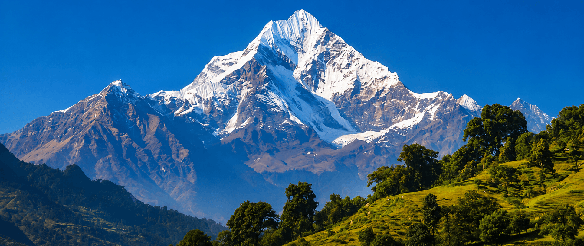
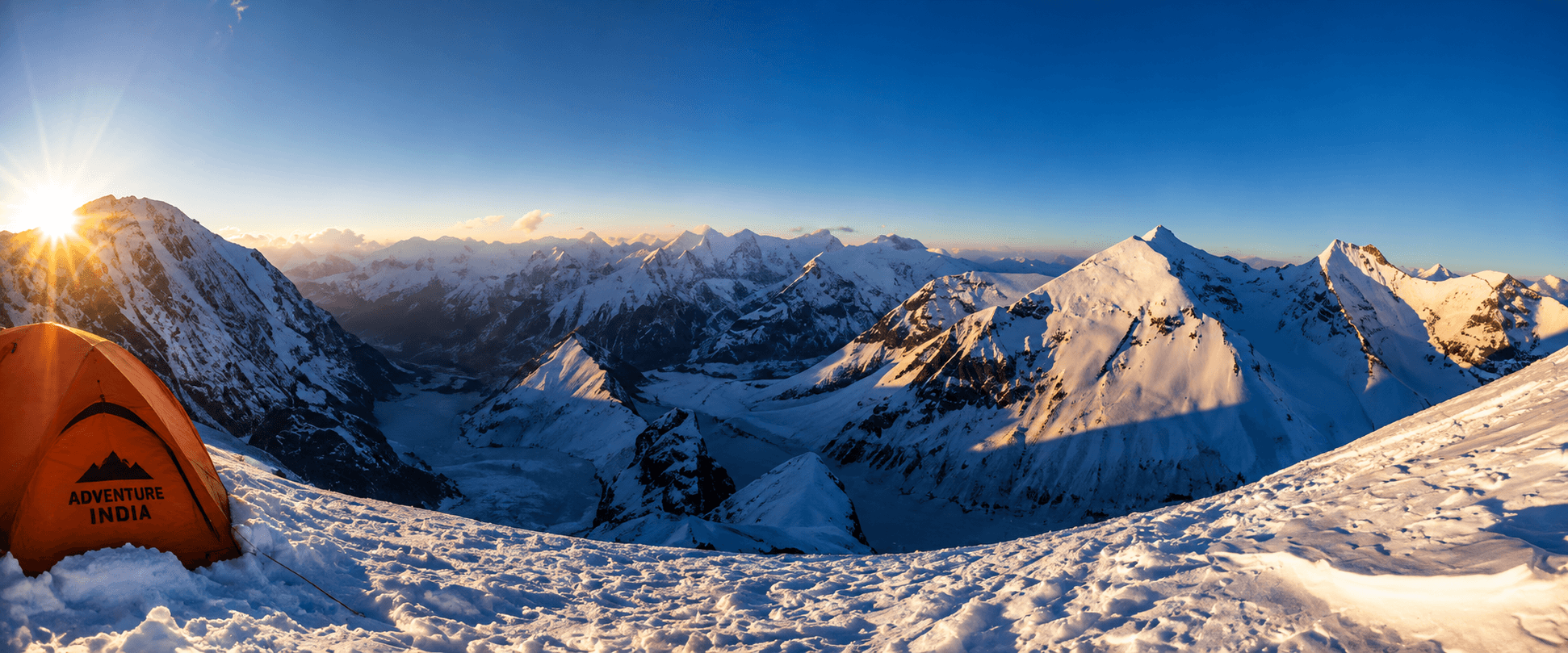
Few mountains in the Himalaya evoke as much reverence, history, and mountaineering prestige as Nanda Devi. Rising to 7,816 metres, Nanda Devi is the second-highest mountain entirely within India and forms the centrepiece of the spectacular Nanda Devi National Park in the Chamoli district of Uttarakhand. The massif comprises two principal summits: Nanda Devi Main (7,816 m) and Nanda Devi East (7,434 m), connected by the Longstaff Col and surrounded by a formidable ring of peaks exceeding 6,500 and 7,000 metres. This natural fortress of glaciers, ridges, and steep valleys makes the mountain one of the most isolated and challenging objectives in the Indian Himalaya.
Nanda Devi occupies a unique place in mountaineering history. Before the ascent of many higher Himalayan peaks, it was regarded as one of the most difficult mountains ever climbed. The legendary mountaineer Tenzing Norgay considered Nanda Devi among the most demanding peaks he encountered, He summited the peak on July 6, 1951, as part of a French expedition. The team initially went to the mountain for a rescue attempt to find two missing French mountaineers. Owing to its religious significance and fragile ecosystem, the Government of India closed climbing on Nanda Devi Main in 1983, a restriction that remains in force today. However, Nanda Devi East (7,434 m) remains open to mountaineering expeditions, subject to special permits and clearances from the relevant government authorities, a process that typically requires several months of advance planning.
Adventure India has a long association with expeditions in this region and, in 2006, provided logistical and operational support to a Spanish expedition. Combining a demanding approach trek, remote glacier travel, and a challenging high-altitude ascent within a UNESCO-recognised mountain wilderness, Nanda Devi East remains one of the finest and most prestigious expedition peaks in India.
ITINERARY
The given program is carefully designed with past experiences, but every mountaineer comes to the same peak with different goals and ambitions. In that case, we are flexible to reduce the length of the expedition to a suitable limit and stretch the duration as per your choice to stay in the mountains. You can also see the cost variation on Alpine Style and Expedition Style choices of the team, which practically takes the exchange of several emails till we reach to final plan. We are not highlighting the details from Base Camp to the summit day because every mountaineer has recorded their different experience. If you require, we can send you the expedition reports submitted by our previous clients to the IMF, and we insist that, even if the summit is not achieved for any reason, we must submit our report, which will pave the path of many mountain enthusiasts in the future.
On your arrival at Delhi international airport, our office staff, most likely your base camp manager will come to receive you and assist you in smooth check in to a hotel centrally located. From here you will find easy to explore Delhi and reach IMF next morning for the briefing. We host the welcome dinner this day in Delhi followed by a casual discussion about your expedition.
Hotel/ Camp- Oberoi Maidens
Meal Plan - Room + Breakfast + welcome dinner
After breakfast, the expedition team attends the mandatory briefing at the Indian Mountaineering Foundation (IMF) in New Delhi. The briefing includes verification of permits, liaison officer formalities (where applicable), environmental regulations, waste-management protocols, safety guidelines, and the latest updates regarding access and conditions in the expedition area. This important administrative process officially clears the team for the expedition and provides an opportunity to resolve any outstanding documentation or logistical requirements.
Following the IMF briefing, the remainder of the day is available for final expedition preparations and optional sightseeing in India's vibrant capital city. Team members may use the time to purchase last-minute equipment, outdoor clothing, batteries, medicines, snacks, or personal supplies from Delhi's well-known outdoor and travel markets. It is also an ideal opportunity to exchange currency, organise communications, and complete final equipment checks before departing for the mountains.
For those interested in exploring Delhi's rich cultural heritage, optional visits can be arranged to some of the city's most famous landmarks, including India Gate, Humayun's Tomb, Qutub Minar, and the bustling markets of Connaught Place. Those seeking a more relaxed day may simply enjoy the hotel's facilities, recover from international travel, and prepare mentally for the adventure ahead.
Hotel/ Camp- Oberoi Maidens
Meal Plan - Half Board
After an early breakfast, we transfer to the railway station to board one of the morning trains for Kathgodam, the traditional railhead for the Kumaon Himalaya. The train journey covers approximately 280 km and takes 5–6 hours, passing through the fertile plains of northern India and offering a fascinating glimpse into everyday life in rural India.
Upon arrival at Kathgodam (approximately 550 m), our expedition vehicles will be waiting for the onward journey to Almora (1,650 m). The drive covers approximately 90 km and takes 3–4 hours, following a winding mountain road through the picturesque Kumaon hills. As we gain altitude, the scenery changes dramatically from the plains to forested ridges, terraced fields, traditional villages, and pine-covered mountainsides.
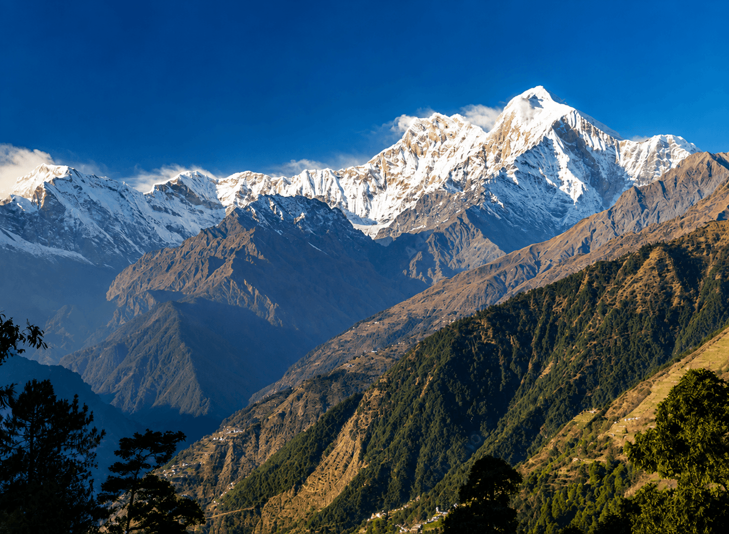
En route, weather permitting, beautiful views emerge of the central Himalayan ranges, including distant glimpses of Nanda Devi, Trishul, Nanda Kot, and Panchachuli peaks. The route passes through the hill stations of Bhimtal and Bhowali, known for their scenic lakes, fruit orchards, and forests of oak and pine. Upon arrival in Almora, one of the cultural capitals of Kumaon, there is time to relax, explore the historic bazaar, or enjoy panoramic views of the Himalayan skyline.
Almora's pleasant climate and moderate altitude make it an ideal halt before proceeding deeper into the mountains towards Munsyari and the Nanda Devi East expedition route.
Hotel/ Camp-
Meal Plan - Full Board
After breakfast, we depart from Almora and continue our journey deeper into the Kumaon Himalaya towards Munsyari (2,150 m), the gateway to the Johar Valley and the starting point for expeditions to Nanda Devi East, Nanda Kot, Hardeol, and the Milam Glacier region. The drive covers approximately 200 km and takes 8–9 hours, traversing some of the most scenic mountain roads in Uttarakhand.
The route passes through picturesque hill towns and traditional Kumaoni villages, including Bageshwar, situated at the confluence of the Saryu and Gomti rivers. Beyond Bageshwar, the road climbs steadily through dense forests of pine, oak, and rhododendron, passing through Kapkot, Tejam, and Birthi, where the spectacular Birthi Waterfall plunges nearly 125 metres into a deep gorge. The journey offers constantly changing views of terraced fields, river valleys, and traditional Himalayan architecture.
As we approach Munsyari, the scenery becomes increasingly dramatic. On clear days, magnificent views emerge of the Panchachuli Group (6,334–6,904 m), one of the most celebrated mountain panoramas in the Kumaon Himalaya. The road follows the upper reaches of the Gori Ganga Valley, a historic trade route once used by traders travelling between India and Tibet.
By late afternoon, we arrive in Munsyari, a beautiful mountain settlement perched on a ridge overlooking the Gori Ganga Valley. Often referred to as the "Little Kashmir of Kumaon," Munsyari serves as the principal base for trekking and mountaineering expeditions in eastern Uttarakhand. The remainder of the day is free to relax, organise equipment, and enjoy the breathtaking views of the Panchachuli peaks, which dominate the northern horizon.
Hotel/ Camp-
Meal Plan - Full Board
Today is reserved for acclimatisation, final expedition preparations, and the completion of local administrative formalities before entering the remote Johar Valley. Although Munsyari lies at a relatively moderate altitude of 2,150 m, this rest day allows team members to recover from the long road journey through Kumaon and begin adapting gradually to the higher elevations that will be encountered during the expedition.
Throughout the day, the expedition leader and support staff complete the necessary local procedures, including verification of permits, coordination with local authorities, porter arrangements, transport logistics, food supplies, and final equipment checks. Team members are encouraged to inspect their personal climbing and trekking equipment, organise loads, and ensure that all essential gear is ready for the approach trek towards the Nanda Devi East Base Camp.
To aid acclimatisation, participants may undertake a short walk around Munsyari or to one of the nearby viewpoints overlooking the Gori Ganga Valley. On clear days, the town offers spectacular views of the magnificent Panchachuli Group (6,334–6,904 m), whose five snow-covered summits dominate the northern skyline. Optional visits can also be made to nearby villages, local markets, or cultural sites, providing an opportunity to experience the traditional lifestyle and hospitality of the Kumaoni mountain communities.
The remainder of the day is free for rest, photography, and enjoying the stunning Himalayan scenery. The relaxed schedule helps ensure that the team begins the trek well-rested, properly organised, and fully prepared for the challenging days ahead.
Hotel/ Camp-
Meal Plan - Full Board
After breakfast, we begin our trek into the historic Johar Valley, following the ancient trade route that once connected the Kumaon Himalaya with western Tibet. The trek starts with a short drive (if road conditions permit) to the roadhead near Darkot and Jimighat, where the trekking trail enters the spectacular Gori Ganga Gorge.
The route follows a well-established mountain trail carved into steep rock faces high above the roaring Gori Ganga River. The trail traverses through mixed forests of pine, oak, and rhododendron, crossing several small streams and waterfalls along the way. One of the highlights of the day is the dramatic gorge section, where the river has cut deeply through the mountains, creating impressive cliffs and narrow passages. Throughout the trek, trekkers can observe traditional stone-built settlements, terraced fields, and the unique culture of the Johari people, who historically traded with Tibet across the high Himalayan passes.
The walk is characterized by a series of gradual ascents and descents rather than a continuous climb. Although Lilam lies at a slightly lower elevation than Munsyari, the trail involves considerable undulation, making the day moderately demanding. As we progress deeper into the valley, the surrounding mountains become increasingly rugged and remote, offering a glimpse of the wilderness that awaits higher up the route towards Milam Glacier and Nanda Devi East.
After approximately 12–14 km of trekking (5–6 hours), we arrive at Lilam (approximately 1,900–2,000 m), a small settlement situated at the confluence of the Gori Ganga and Lilam Gad streams. Surrounded by dense forests and steep mountain slopes, Lilam serves as the traditional first campsite on the route to the Milam Glacier and Nanda Devi East region.
Hotel/ Camp- Adventure India Trekking Camp
Meal Plan - Full Board
After breakfast, we continue our journey deeper into the spectacular Johar Valley, following the ancient trade route that once connected the Kumaon Himalaya with Tibet. Today's trek is one of the most scenic sections of the approach, as the trail follows the roaring Gori Ganga River through dense forests, narrow gorges, and dramatic mountain landscapes.
The route involves a steady ascent of approximately 500–550 metres, traversing well-defined mountain paths carved into steep valley walls. Along the way, trekkers cross several wooden and steel bridges spanning side streams and glacial torrents that descend from the surrounding peaks. The trail alternates between forested sections of oak, pine, birch, and rhododendron and more open stretches that provide impressive views of the deep Gori Ganga gorge below. Although technically straightforward, the route includes a number of exposed traverses, rocky sections, and short ascents and descents that require sure footing, particularly during wet weather.
As altitude is gained, the valley gradually widens and the landscape becomes increasingly alpine in character. During the summer months, trekkers frequently encounter local shepherds (Bhotiyas and Gaddis) moving with large flocks of sheep, goats, and horses towards the high mountain pastures. These seasonal migrations have been a feature of the Johar Valley for centuries and add to the cultural richness of the journey.
After approximately 12 km of trekking (5–6 hours), we arrive at Bugdiar (2,480 m), a beautiful campsite situated on a broad meadow beside the Gori Ganga River. Surrounded by forests and towering mountain slopes, Bugdiar serves as an important halt on the route to Milam Glacier and Nanda Devi East. The campsite offers a peaceful setting to rest, acclimatise, and enjoy the sounds of the river flowing through the valley.
Hotel/ Camp- Adventure India Trekking Camp
Meal Plan - Full Board
After breakfast, we continue our ascent through the historic Johar Valley, trekking from Bugdiar to the ancient village of Martoli, one of the most culturally significant settlements on the route to the Milam Glacier and Nanda Devi East. Today's trek marks a noticeable transition from the densely forested lower valley to the more open alpine landscapes of the upper Himalaya.
The trail initially follows the Gori Ganga River, gradually climbing through birch, pine, and rhododendron forests before reaching the narrow gorge section near Rilkot (approximately 3,100 m), a small seasonal settlement traditionally used by shepherds and traders. Beyond Rilkot, the valley widens considerably, revealing magnificent views of snow-clad peaks, hanging glaciers, and the upper reaches of the Johar Valley. The route consists of well-defined mountain trails with several steep sections, rocky traverses, and continuous altitude gain. While technically straightforward, the significant ascent of nearly 900 metres requires a steady pace and careful hydration.
As the trail emerges above the tree line, the landscape becomes increasingly alpine, characterised by broad grassy slopes, glacial streams, and panoramic mountain views. During clear weather, trekkers may catch their first distant views of prominent peaks of the Kumaon Himalaya, including sections of the Nanda Devi East, Nanda Kot, and surrounding glacier systems that dominate the northern horizon.
After approximately 14 km of trekking (6–7 hours), we arrive at Martoli (3,350 m), a historic village once inhabited by prosperous Johari traders who conducted commerce with Tibet before the closure of the Indo-Tibetan border. Today, the stone houses and ancient temple structures stand as reminders of the region's rich cultural heritage. Situated on an elevated terrace above the Gori Ganga Valley, Martoli offers one of the most spectacular viewpoints in the Kumaon Himalaya.
The campsite near Martoli provides breathtaking views of Nanda Devi East (7,434 m), Nanda Kot (6,861 m), Hardeol (7,151 m), and numerous glacier-fed valleys. The remainder of the day is devoted to rest, acclimatisation, and exploring the historic village surroundings.
Hotel/ Camp- Adventure India Trekking Camp
Meal Plan - Full Board
After breakfast, we continue our journey into the heart of the historic Johar Valley, trekking from Martoli to the ancient village of Milam (3,500 m). Although the distance is relatively short, today's route is one of the most fascinating sections of the approach, combining spectacular Himalayan scenery with the rich cultural heritage of the old Indo-Tibetan trade route.
The trail follows the upper Gori Ganga Valley, traversing broad alpine slopes and glacial terraces with a gradual altitude gain of approximately 150 metres. The route passes through the abandoned settlements of Burfu and Bilju, once thriving trading communities whose inhabitants regularly crossed the high Himalayan passes into Tibet. The path is generally well-defined and technically straightforward, consisting of dirt trails, rocky sections, river terraces, and occasional stream crossings. Compared to previous days, the walking is relatively easy, making it an ideal acclimatisation stage before entering the glacial regions beyond Milam.
As the valley opens further, trekkers are rewarded with increasingly dramatic views of the surrounding mountains and glacier systems. The snow-covered summits of Hardeol (7,151 m), Nanda Devi East (7,434 m), Nanda Kot (6,861 m), Trishuli, and numerous unnamed peaks dominate the skyline. The terrain becomes distinctly alpine, with sparse vegetation, glacial outwash plains, and expansive mountain vistas characteristic of the high Himalaya.
After approximately 11 km of trekking (4–5 hours), we arrive at Milam, one of the most famous historical villages in Kumaon. Situated near the snout of the Milam Glacier, the village was once a major trading centre on the trans-Himalayan route to Tibet. Although largely abandoned after the closure of the Indo-Tibetan border, its stone houses, ancient pathways, and spectacular setting continue to make it one of the most evocative destinations in the Indian Himalaya.
The remainder of the day is devoted to rest and acclimatisation. The open valley around Milam provides excellent opportunities for photography and exploration while allowing the team to prepare for the higher and more demanding stages of the expedition ahead.
Hotel/ Camp- Adventure India Trekking Camp
Meal Plan - Full Board
After breakfast, we leave the historic village of Milam and enter a far more remote and less-travelled section of the expedition route. Today's trek takes us away from the main Milam Glacier trail and into the beautiful Lawan Valley, which provides access to the eastern approaches of Nanda Devi East (7,434 m), Hardeol (7,151 m), and the extensive glacier systems surrounding the mountain.
The route initially follows the upper Gori Ganga Valley before turning eastward into the valley carved by the Lawan Gad, a powerful glacier-fed stream originating from the Lawan Glacier. The trail traverses broad alpine slopes, glacial terraces, and sections of rocky moraine while gradually gaining altitude. Unlike the previous day's relatively easy walking, today's route becomes more demanding as it involves longer stretches of uneven terrain, frequent stream crossings, and several steep ascents above the river gorge.
The trail remains well-defined but passes through increasingly rugged mountain terrain. Trekkers encounter sections of loose rock, landslide-prone slopes, and glacial debris that require careful footing, particularly after rain or during periods of snowmelt. As the expedition moves deeper into the Lawan Valley, magnificent views emerge of Hardeol, Rishi Pahar, Nanda Khat, and numerous unnamed peaks rising above the glacier systems of the Kumaon Himalaya. The valley itself is renowned for its dramatic scenery, alpine meadows, and rich wildlife, including Himalayan bharal (blue sheep), marmots, and occasional sightings of Himalayan griffons.
After approximately 13 km of trekking (6–7 hours) and a gradual altitude gain of nearly 200 metres, we arrive at Lwani (3,690 m), a beautiful high-altitude meadow situated near the confluence of the Lawan Gad and the upper valley streams. Surrounded by towering peaks and glacier-fed rivers, Lwani serves as an important acclimatisation camp and a traditional staging point for expeditions heading towards the Lawan Glacier and Nanda Devi East.
The remainder of the day is devoted to rest, acclimatisation, and preparation for the increasingly remote glacial terrain ahead. As the expedition is now approaching 4,000 metres, trekkers are encouraged to maintain a steady pace, remain well hydrated, and monitor their acclimatisation carefully.
Hotel/ Camp- Adventure India Trekking Camp
Meal Plan - Full Board
After breakfast, we leave the meadows of Lwani and continue deeper into the remote Lawan Valley, following the route that has been used by generations of mountaineers approaching Nanda Devi East (7,434 m). Today's trek takes us into a truly alpine environment where vegetation gradually disappears and the landscape becomes dominated by glaciers, moraine ridges, and towering Himalayan peaks.
The trail follows the Lawan Gad upstream through a broad glacial valley, gradually ascending towards the Lawan Glacier. The route involves a mixture of alpine trails, rocky moraine, glacial outwash plains, and occasional stream crossings. As altitude increases, the terrain becomes increasingly rugged, requiring careful footing over loose stones and moraine debris. Although the gradient is generally moderate, the reduced oxygen levels above 4,000 metres make steady pacing essential.
Throughout the day, spectacular views unfold of the eastern ramparts of the Nanda Devi Sanctuary, including Nanda Devi East (7,434 m), Nanda Khat (6,611 m), Hardeol (7,151 m), Rishi Pahar (6,992 m), and the extensive glacier systems that feed the Lawan Valley. The route also passes through areas rich in Himalayan wildlife, where sightings of bharal (blue sheep) and Himalayan griffons are not uncommon.
After approximately 13 km of trekking (5–6 hours) and an altitude gain of around 520 metres, we arrive at Nanda Devi East Base Camp (4,210 m). Situated on a broad moraine terrace overlooking the Lawan Glacier, the campsite offers magnificent panoramic views of the mountain and the surrounding peaks. This camp serves as the principal operational base for the climbing phase of the expedition and is one of the most spectacular base camp locations in the Kumaon Himalaya.
Upon arrival, the team establishes camp, organises equipment, and begins preparations for the higher camps. The remainder of the day is devoted to rest, hydration, and acclimatisation, allowing participants to adjust to the increasing altitude before entering the technical mountaineering phase.
Hotel/ Camp- Adventure India Trekking Camp
Meal Plan - Full Board
Today is reserved for acclimatization and the establishment of our expedition base camp. Proper acclimatization is essential for a safe and successful ascent, allowing the body to gradually adapt to the increasing altitude before moving higher on the mountain.
The day is spent organizing personal and group equipment, sorting food supplies, setting up communication systems, and preparing climbing gear for the days ahead. The expedition leader will conduct a detailed briefing on route conditions, safety procedures, and the climbing strategy.
Participants may undertake a short acclimatization hike to nearby ridges overlooking the Gangotri Glacier, returning to base camp for rest and recovery. These walks not only aid acclimatization but also provide outstanding views of Shivling, Bhagirathi I, II & III, Meru, and the surrounding glaciated peaks.
The remainder of the day is free to relax, enjoy the spectacular Himalayan scenery, and make final preparations for the ascent.
Hotel/ Camp- Adventure India Trekking Camp
Meal Plan - Full Board
These days are reserved for the technical climbing phase of the expedition, during which the team acclimatises, establishes higher camps, ferries loads, and prepares for the summit attempt on Nanda Devi East (7,434 m). The exact schedule depends on weather conditions, snow stability, glacier conditions, and the acclimatisation progress of the climbers. Flexibility during this phase is essential, as Himalayan conditions can change rapidly.
From Base Camp (4,210 m), climbers undertake a series of acclimatisation rotations following the mountaineering principle of "climb high, sleep low." During these rotations, team members carry personal equipment and supplies to higher camps before returning to lower elevations for recovery. Simultaneously, High Altitude Porters (HAPs) and climbing staff transport ropes, fuel, food, and technical equipment while opening the route and assessing objective hazards such as crevasses, seracs, avalanche-prone slopes, and snow conditions.
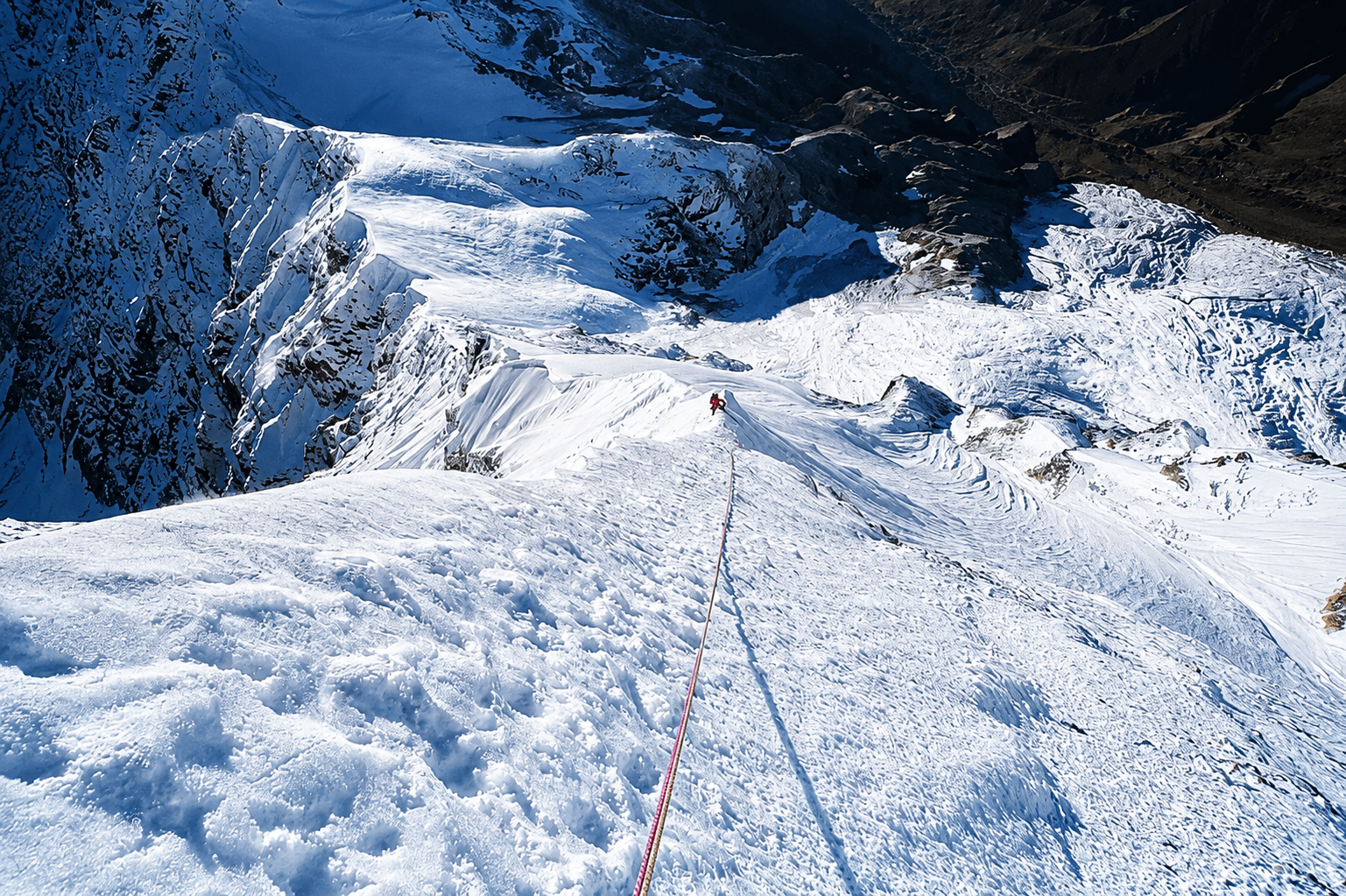
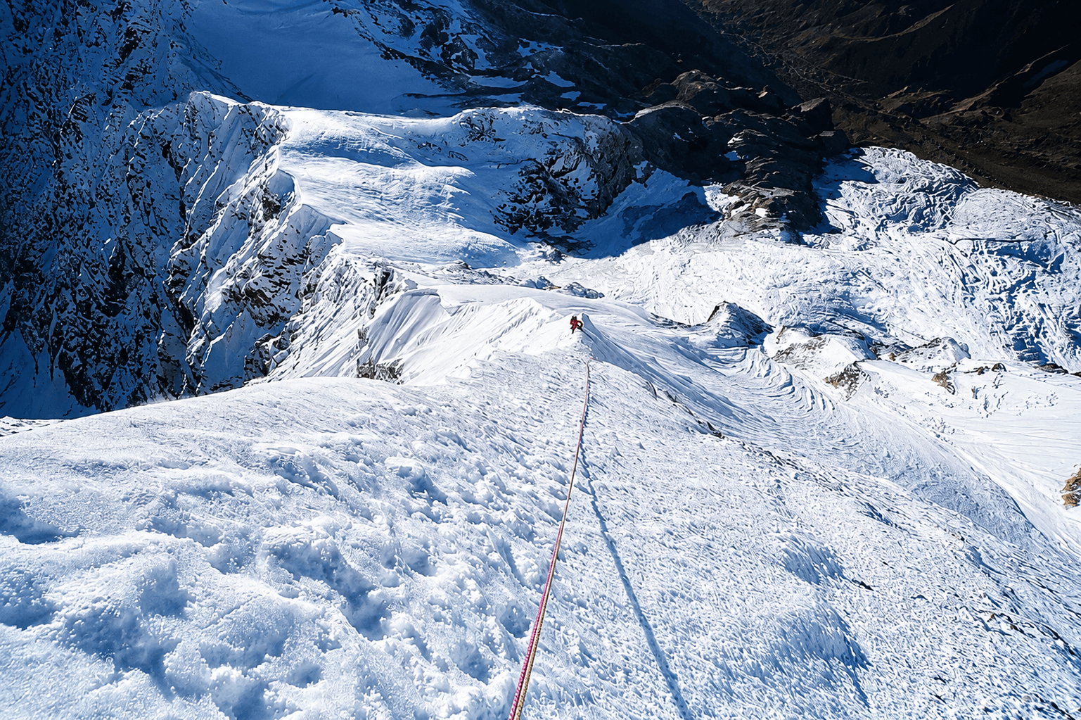
The route above Base Camp follows the Lawan Glacier and its upper basin, involving extensive glacier travel across crevassed terrain. Climbers negotiate snowfields, moraine ridges, icefalls, and mixed sections of snow, ice, and rock. Depending upon seasonal conditions, fixed ropes are installed on steeper sections, particularly above Camp I and along the upper slopes leading towards Longstaff Col and the summit ridge. Team members are expected to be proficient in the use of crampons, ice axe, harness, ascenders (jumars), descenders, and fixed-rope systems, as well as glacier travel techniques.
Typically, Camp I is established between 5,000–5,300 m on the upper glacier, Camp II around 5,800–6,000 m near the approach to Longstaff Col, and Camp III between 6,300–6,500 m, depending on prevailing conditions and route selection. Above Camp II, the climb becomes increasingly demanding, with sustained snow and ice slopes often ranging between 40° and 55°, exposed traverses, crevasse fields, and high-altitude terrain where weather and altitude become major factors.
Throughout this period, climbers are provided with full expedition rations at Base Camp and specialised high-altitude food at the upper camps. Meals are designed to maximise energy intake and typically include soups, dehydrated meals, pasta, rice, energy bars, dried fruits, nuts, hot drinks, and other easily digestible foods suitable for extreme altitude conditions. Proper hydration, nutrition, and acclimatisation remain critical factors in preparing the team for a safe and successful summit attempt.
Hotel/ Camp- Base Camp, Camp I, Camp II, and Camp III as per expedition progress
Meal Plan- Full Board at Base Camp and High-Altitude Expedition Rations at Higher Camps
Technical Highlights: Glacier travel, crevasse navigation, fixed-rope climbing, snow and ice slopes up to 55°, mixed alpine terrain, high-altitude camping above 6,000 m, and preparation for one of the most prestigious mountaineering objectives in the Indian Himalaya.
These days are intentionally reserved as buffer or contingency days, a critical component of any major Himalayan expedition. On a peak such as Nanda Devi East (7,434 m), success is often determined not only by the strength and preparation of the climbers but also by weather, snow conditions, avalanche risk, and the acclimatisation status of the team. As a result, maintaining sufficient reserve days significantly increases both safety and summit success rates.
The contingency period may be used for several purposes, including additional acclimatisation rotations, route maintenance, re-establishing camps after adverse weather, waiting for a suitable summit window, or making a second summit attempt if conditions during the initial attempt prove unfavourable. Strong winds, heavy snowfall, poor visibility, unstable snowpack, or health concerns among team members may require the expedition to delay movement to higher camps until safer conditions prevail.
During these days, climbers typically remain at Base Camp, Camp I, Camp II, or Camp III, depending on the overall expedition strategy and weather forecast. The expedition leadership continuously evaluates meteorological reports, glacier conditions, snow stability, and team fitness before authorising any movement towards the summit. Flexibility and patience during this phase are often the key factors that separate successful expeditions from unsuccessful ones.
Should the summit already have been achieved, these reserve days provide valuable flexibility for a relaxed and safe descent, equipment recovery, camp dismantling, and contingency planning in the event of unforeseen delays caused by weather, route conditions, or logistical considerations.
Hotel/ Camp- Base Camp or Higher Camps as required
Meal plan- Full Board at Base Camp and High-Altitude Expedition Rations at Higher Camps
Purpose: Weather contingency, additional acclimatisation, route preparation, summit window selection, emergency reserve, or a second summit attempt if required.
Expedition Note: On major Himalayan peaks, contingency days are regarded as an essential safety margin rather than spare days. The most successful expeditions are often those that exercise patience and wait for the right weather window rather than forcing a summit attempt under marginal conditions.
Following the summit phase and the completion of climbing activities on Nanda Devi East (7,434 m), the team begins its descent from the upper mountain back to Base Camp. These two days are reserved for the safe withdrawal of personnel and equipment from the higher camps, allowing sufficient time to negotiate the technical sections of the route without rushing.
The descent retraces the established route through Camp III, Camp II, and Camp I, crossing glaciated terrain, crevasse fields, snow slopes, and fixed-rope sections that were used during the ascent. Particular care is required during the descent, as fatigue, changing snow conditions, and afternoon softening of glacier surfaces can increase objective hazards. Climbers remain roped where necessary and continue to use crampons, ice axes, and fixed-rope systems on exposed sections until safely below the technical terrain.
Throughout the descent, the High-Altitude Porters (HAPs) play a vital role in dismantling the higher camps and transporting expedition equipment, fixed ropes, fuel, tents, and supplies back towards Base Camp. Their support allows team members to descend more efficiently while ensuring that all equipment and waste are removed from the mountain in accordance with responsible expedition practices.
Upon arrival at Base Camp (4,210 m), climbers can finally enjoy the comforts of a lower altitude, warmer conditions, and a more relaxed environment after many days spent on the mountain. The remainder of the time is devoted to rest, equipment organisation, route debriefing, and preparation for the long trek back through the Lawan and Johar Valleys.
Hotel/ Camp- Adventure India Trekking Camp
Meal Plan - Full Board
After breakfast, we begin our return journey from Base Camp, retracing the route down the beautiful Lawan Valley. The trail descends gradually through alpine meadows, moraine terraces, and glacier-fed valleys before rejoining the historic Johar Valley route near Lwani. Continuing past the Lawan Gad, we follow the Gori Ganga Valley to the ancient village of Milam, once an important trading centre on the Indo-Tibetan trade route. This is a long but predominantly downhill trekking day offering magnificent views of the surrounding peaks and glaciers.
Hotel/ Camp- Adventure India Trekking Camp
Meal Plan - Full Board
Today we continue descending through the historic Johar Valley, passing the traditional settlements of Burfu, Martoli, and Rilkot. The route follows the Gori Ganga River through alpine pastures, rocky mountain trails, and forested sections. As altitude decreases, vegetation becomes more abundant and the valley gradually transforms from a high-altitude glacial landscape into a greener Himalayan environment. By late afternoon, we arrive at the riverside campsite of Bugdiar.
Hotel/ Camp- Adventure India Trekking Camp
Meal Plan - Full Board
After breakfast, we undertake the final trekking day of the expedition. The trail follows the Gori Ganga Gorge through forests of pine, oak, and rhododendron, passing through Lilam and continuing along the historic Johar Valley route. The trek involves a mixture of ascents, descents, suspension bridges, and cliff-side traverses before reaching the roadhead. Vehicles then transfer the team to Munsyari, where the comforts of a hotel, hot showers, and a celebratory dinner provide a welcome conclusion to the trekking phase of the expedition.
Hotel/ Camp-
Meal Plan - Full Board
Following breakfast, we depart Munsyari and begin the scenic drive through the Kumaon Himalaya towards Almora. The route follows the Gori Ganga Valley via Birthi, Tejam, Kapkot, and Bageshwar, passing forests, terraced fields, traditional villages, and spectacular mountain scenery. Weather permitting, final views of the Panchachuli Peaks accompany us during the early stages of the journey. By evening, we arrive in the historic hill town of Almora, one of the cultural centres of Kumaon.
Hotel/ Camp-
Meal Plan - Full Board
After breakfast, we bid farewell to the Kumaon Himalaya and drive from Almora to Kathgodam, the principal railhead serving the region. The scenic drive of approximately 90 km takes 3–4 hours, descending through pine-covered hills, traditional Kumaoni villages, fruit orchards, and the picturesque lake district around Bhimtal and Bhowali.
Upon arrival at Kathgodam, there is time to relax and complete any final packing before boarding the afternoon or evening train to Delhi. The rail journey covers approximately 280 km and takes 5–6 hours, offering a final glimpse of rural northern India as the train travels from the Himalayan foothills to the capital city. Depending on the train schedule, arrival in Delhi is generally late evening or at night.
This day marks the formal conclusion of the mountain phase of the expedition and provides an opportunity to reflect on the remarkable journey through the Johar Valley and the ascent of Nanda Devi East.
Hotel/ Camp- Overnight train or Hotel in Delhi depending on departure time.
Meal Plan – As per the journey schedule
Upon arrival in Delhi, the team transfers to the hotel for freshening up and breakfast. Later in the morning, the expedition leader, Liaison Officer (LO), and team representatives attend the mandatory post-expedition debriefing at the Indian Mountaineering Foundation (IMF). This final meeting includes the submission of expedition reports, environmental compliance documentation, climbing details, route information, and observations regarding mountain and glacier conditions encountered during the expedition.
The debriefing also provides an opportunity to share valuable information with the IMF and future climbing teams, contributing to the collective knowledge of the mountain. Following completion of the formalities, the remainder of the day is free for relaxation, sightseeing, last-minute shopping, or preparation for international travel.
At the appropriate time, transfer is provided to Indira Gandhi International Airport for onward flights. The expedition concludes with memories of one of the most iconic and challenging mountaineering objectives in the Indian Himalaya.
Hotel/ Camp- Hotel use
Meal Plan – Breakfast
Frequently Asked Questions
Cost: N/A USD
Adventure India operates a conservation initiative in the Himalaya, focusing on environmental awareness among high-altitude village youth and women. These communities live in the most ecologically sensitive zones, where daily life depends directly on fragile natural resources, such as glaciers, forests, water sources, grazing lands, and weather cycles. By beginning education and advocacy within these settlements, we aim to strengthen local stewardship and create long-term guardianship of mountain ecosystems.
You are welcome to contribute to this programme either through financial support or by offering your time and expertise. If your schedule allows, you may also join us as a resource person in one of our forthcoming workshops, training sessions, or field-based conservation activities.
Project Cause is a dedicated health-awareness initiative launched in 2024, following the fourth-stage breast cancer diagnosis of one of our core team members, a seasoned mountain traveller with extensive Himalayan trekking experience, including Everest Base Camp and multiple high-altitude rescue operations on the frozen Zanskar River. After confronting the disease with remarkable strength and ultimately overcoming it, she committed herself to creating awareness, encouraging early detection, and offering counselling to women across the Himalayan belt, from Ladakh to Arunachal Pradesh.
Adventure India is honoured to collaborate in this mission. Together, we organise medical outreach camps in remote mountain settlements, where she and specialised oncologists from one of India’s leading cancer institutes provide screening, consultations, education, and emotional support to local women. In many of these regions, conversations around breast cancer remain socially restricted or dismissed, making this intervention not only medical but deeply transformational.
Your contribution, whether financial or voluntary, will directly support Himalayan women living in some of the world’s most inaccessible terrains, where healthcare access is minimal and the stigma around cancer remains strong. By donating to Project Cause, you help ensure early testing, informed dialogue, and dignified support for a population often left unseen in the wider healthcare discourse.
Terms and Conditions
1. Eligibility: Fitness, Experience & Motivation
All participants must be physically fit, technically prepared, and mentally motivated for high-altitude climbing. Your mountaineering résumé and experience records will be reviewed before we submit the team application to the Indian Mountaineering Foundation (IMF).
While peaks above 7,000 m demand exceptional stamina and technical competence, numerous Himalayan summits below 6,000 m are equally challenging due to route complexity, weather exposure, remoteness, and objective hazards.
2. Delayed Departure & Early Closure
Expedition timelines may shift due to weather, route conditions, medical concerns, permit directives, or the leader’s safety decisions.
- Delayed closure: Any extension of the itinerary will incur additional charges.
- Early pack-up/retreat: Should the expedition conclude earlier than scheduled, no refund will be provided.
- Any extra transport, hotel stay, lodge/camp nights, or logistical support arising out of delays, roadblocks, medical evacuation, or administrative regulation will be billed separately on a cost-to-cost basis.
3. Satellite Phones, Filming & Drone Permissions
Satellite communication devices are subject to regional security restrictions and cannot be used freely across the Himalaya.
- Only company-registered satellite phones may be used, and will be provided on additional rental in the areas allowed by the Indian Government.
- Drone operations, documentary filming, and aerial recording require prior permits, which vary by district, border zone, and wildlife protection area.
All protocols must be strictly followed to avoid administrative intervention or penalties.
4. Refund Policy
All refund considerations will follow the official cancellation policy issued along with your expedition dossier. Refunds, where applicable, will be processed only as per those terms.
5. Health, Insurance, Rescue & Indemnity
Participants must hold valid high-altitude insurance, including evacuation coverage.
- Any emergency medical service, evacuation helicopter, ground rescue, insurance activation, or hospitalisation can be coordinated through us in the knowledge of LO, but must be paid directly by the team or the insurer.
- All members are required to sign an Indemnity & Risk Acceptance Bond with Adventure India before departure.
6. Booking Confirmation
Once all expedition details, services, and logistics are finalised, the following payment schedule applies:
- 50 % of the expedition fee + IMF fee at the time of confirmation
- Remaining balance payable 61 days before expedition commencement
- 100% advance payment is required for last-minute bookings (booking within 61 days before departure)
7. Non-Refundable / Non-Credit Services
Expedition pricing is quoted as a complete logistical package, not as itemised services.
Therefore, no partial refunds, credits, or adjustments will be issued for unused services (e.g., unused load-ferry, camp nights, high-altitude rations, guide days, transport segments, etc.).
We strongly recommend purchasing full travel cancellation insurance at the time of booking.
8. Replacement Participant
If you nominate another climber to take your place:
- All cancellation charges will be fully waived provided:
- The replacement climber meets the fitness and mountaineering requirements, and
- Secures IMF approval and permit to climb the peak.
9. Sightseeing & Post-Expedition Extensions
Following intense climbing periods in remote high-altitude environments, we encourage participants to decompress and experience India’s cultural and natural richness.
Extension trips may be arranged at additional cost to:
- Taj Mahal / Agra
- Rajasthan Desert & Fort Circuit
- Ladakh & Trans-Himalaya Culture
- Goa / Konkan Coast
- South India (Kerala, Tamil Nadu, Karnataka)
- Northeast India or custom destinations
Cancellation policy
| Cancellations made more than 60 days before departure | A cancellation fee of 10% of the total trip cost will be charged, and the remaining amount will be refunded. |
| Cancellations made between 45 and 60 days before departure | A cancellation fee of 25% of the total trip cost will be charged, and the remaining amount will be refunded. |
| Cancellations made between 30 and 45 days before departure | A cancellation fee of 50% of the total trip cost will be charged, and the remaining amount will be refunded. |
| Cancellations made less than 30 days before departure | The entire deposit will be forfeited. |
UIAA Grade and UIAA Declaration
AD+ to D- (Assez Difficile Plus to Peu Difficile Minus)
This places Nanda Devi East in the category of a serious Himalayan expedition peak requiring both strong mountaineering skills and high-altitude experience. The UIAA grade of Nanda Devi East (7,434 m) depends on the route being climbed, but the standard South Ridge / Longstaff Col route—the route normally attempted from the Milam–Lawan Glacier side is generally considered.